

The Chokepoint That Could Decide Asia — and the Islands India Tries Not to Talk About
An investigation into the Strait of Malacca, the "Malacca Dilemma," and a sliver of Indian territory closer to Sumatra than to Delhi.

There is a stretch of water on the far side of the Bay of Bengal that almost no one in the West could find on a map.
It has no flag of its own. No army guards it. At its tightest, you could swim across it before lunch.
And yet, if it closed tomorrow morning, by the afternoon oil futures would be screaming, the price at the pump in three continents would jump, factory managers in Guangdong would start counting their days of inventory, and somewhere in Washington a duty officer would be waking up an admiral.
This is the Strait of Malacca.
It is not a Hollywood plot device. It is geography. And geography, as the old line goes, is destiny.
What follows is the story of why the most powerful navies on Earth keep one eye permanently on this narrow seam of ocean — and why a chain of Indian islands that most Indians have never visited may be quietly holding one of the most valuable cards in modern Asia.
Pull the thread, and it leads somewhere uncomfortable.
ACT I — The Wound in the Map
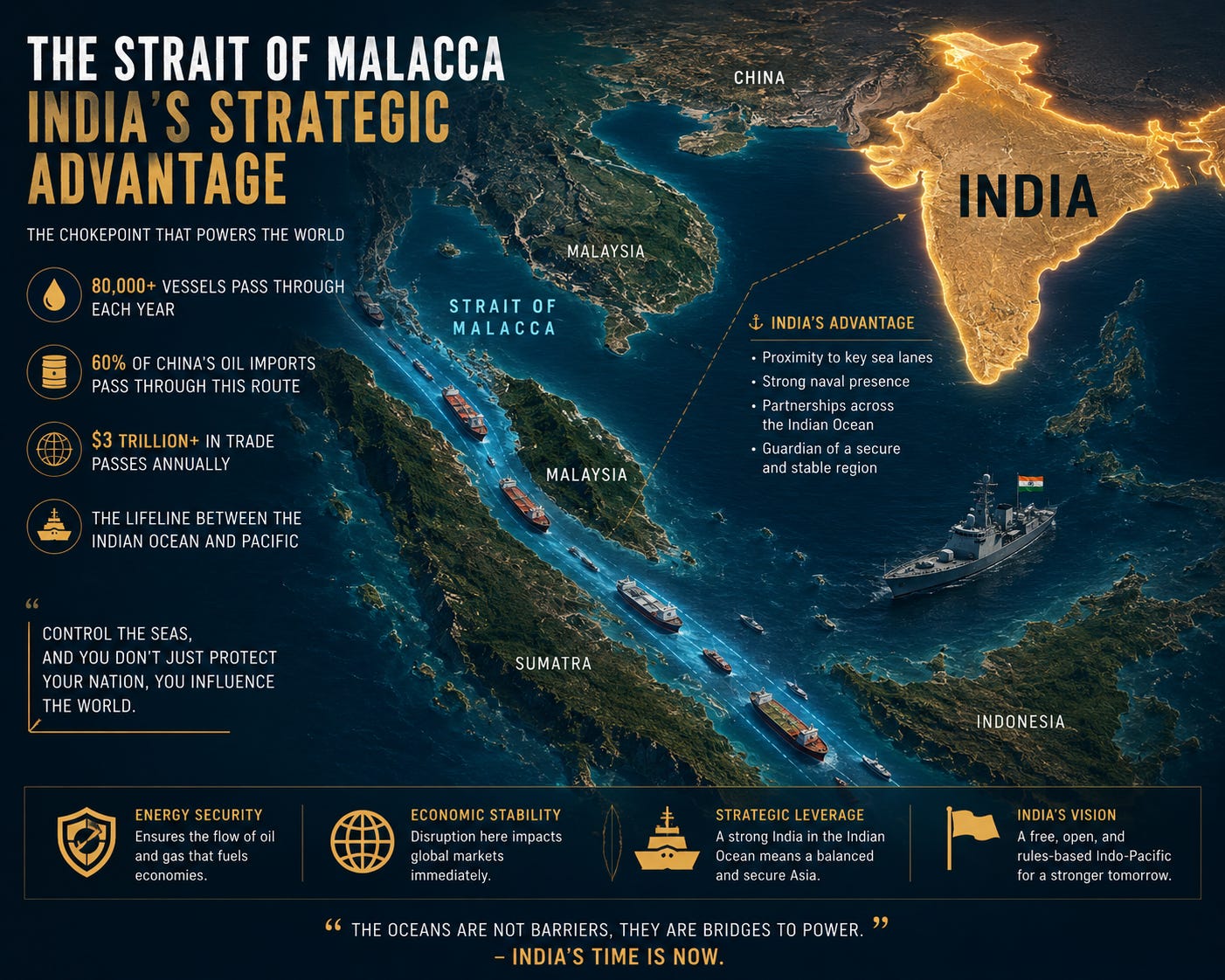
Run your finger down the long throat of Southeast Asia. Between the Indonesian island of Sumatra on one side and the Malay Peninsula on the other lies a funnel of water roughly 890 kilometres long. It connects the Indian Ocean to the South China Sea, and through it runs the shortest sea route from the oil fields of the Persian Gulf to the factories of East Asia.
It is also a trap.
At its narrowest — the Phillips Channel near Singapore — the navigable lane pinches down to about 1.7 miles, roughly 2.7 kilometres, according to the U.S. Energy Information Administration (EIA). The water is shallow enough that the largest tankers afloat have a dedicated size class — “Malaccamax” — built to scrape over the bottom with metres to spare. One grounding, one collision, one sunk hull in the wrong place, and the busiest oil artery on the planet starts to clot.
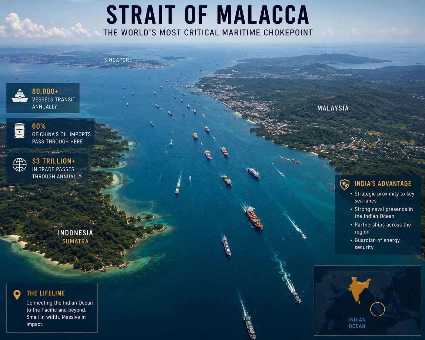
And it is the busiest. The EIA’s own chokepoint data is blunt about it: in the first half of 2025, an estimated 23.2 million barrels of oil per day moved through Malacca — about 29 percent of all the oil that travels by sea anywhere on Earth. That is more than the Strait of Hormuz, the chokepoint everyone fears when Iran rattles its sabre; Hormuz averaged around 20.9 million barrels a day over the same period. Of the Malacca volume, the EIA breaks it down to roughly 16.6 million barrels a day of crude and condensate and another 6.5 million barrels of refined products, plus about 9.2 billion cubic feet of liquefied natural gas every day.
Depending on how you count vessels, somewhere between 60,000 and 90,000 ships thread this passage every year — figures cited range from “over 60,000” (Wikipedia’s tally) to around 90,000 in industry write-ups. By various estimates it carries close to a quarter of the world’s traded goods. Oil, gas, iron ore, copper, rubber, palm oil, electronics, the contents of half the shipping containers on your continent.
Now hold one number in your head, because the whole story turns on it.
The single largest destination for the crude pouring through Malacca is China — about 7.9 million barrels a day in the first half of 2025, nearly 48 percent of all the crude moving through the strait, according to figures reported from the EIA by Bernama and Malay Mail.
One narrow channel. Half a planet’s seaborne oil. And the largest customer is a country that does not control a single metre of it.
That is not a footnote. That, as Beijing learned the hard way, is a noose.
ACT II — The Sentence That Has Haunted Beijing for Twenty Years
In November 2003, at a Communist Party economic work conference, China’s then-leader Hu Jintao said something that has echoed through Chinese strategy ever since. He warned that “certain major powers” could one day choke off the Strait of Malacca — and with it, China’s lifeline.
The Chinese strategists gave the fear a name: the Malacca Dilemma (马六甲困局).
Here is why it keeps them awake. China is the world’s largest energy consumer, accounting for roughly a quarter of global energy use, and it imports the majority of its oil from the Middle East and Africa. By the most widely cited estimate — repeated by everyone from RealClearDefense to the Atlas Institute to Wikipedia — around 80 percent of China’s imported crude oil passes through the Strait of Malacca, along with roughly 60 percent of its total seaborne trade. One analyst, quoted in RealClearDefense, calls it simply China’s “Achilles’ heel.”
Read that again. The world’s second-largest economy — the workshop of the planet, a nuclear power, a builder of aircraft carriers — runs on energy that must squeeze through a 2.7-kilometre gap it cannot defend, watched over by the U.S. Navy and its allies.
What would a closure actually mean? The geopolitics outlet GEOPOL lays out the worst-case scenario starkly: in a conflict with the United States, American naval power could potentially interdict Chinese shipping at Malacca and “strangle” the Chinese economy within weeks. Imagine a nation of 1.4 billion watching fuel prices spike, factories idle, and supply chains seize — the financial analysts at Dark Horse Financial sketch exactly that nightmare in the context of a Taiwan crisis.
There is a historical ghost in this room, and Chinese planners know it well. In 1941, Imperial Japan imported roughly 80 percent of its oil from the United States — and when Washington moved toward an embargo, Tokyo concluded it had two choices: capitulate, or strike first. It chose Pearl Harbor. The parallel is not lost on Beijing, and it is one reason the Malacca Dilemma is treated not as an economic inconvenience but as an existential question.
This is the geopolitical equivalent of a man who has built a mansion and discovered, too late, that the only road to it runs through his rival’s front yard.
So the obvious question becomes: whose front yard is it?
ACT III — The Islands That Look Like They’re in the Wrong Country
Here is where the map plays a trick on you.
Pull back from the strait and look at what sits just outside its western mouth, scattered across the eastern Bay of Bengal: more than 800 islands, islets and rocks, only about three dozen of them inhabited. The chain is so far from the Indian mainland — roughly 1,200 kilometres — and so close to Southeast Asia that a first-time visitor would assume it belongs to Indonesia, Myanmar, or Thailand.
It doesn’t. It’s India.
This is the Andaman and Nicobar archipelago. And its southern tip is the punchline.
Indira Point, on Great Nicobar Island, is the southernmost point of the Republic of India. It sits about 150 kilometres from Sumatra — closer to Indonesia than many Indian cities are to each other. Indonesia’s northernmost island, Rondo, lies just 145 kilometres (80 nautical miles) to the south, across the channel that funnels traffic into Malacca. The northern end of the chain is even more provocative: the northernmost Andamans sit barely 55 kilometres — under 50 miles — from Myanmar’s Coco Islands. The strait itself, by one account in the Deccan Herald, is little more than 100 kilometres and an hour’s flight away.
In other words: India does not sit near the gateway to the Strait of Malacca.
India sits on top of it.
Every year, tens of thousands of ships bound for or returning from the strait pass through the Ten Degree Channel between the Andaman and Nicobar groups, and the Six Degree Channel between the Nicobars and Sumatra — waterways that run, quite literally, between Indian islands. The territory’s former lieutenant governor, retired Admiral Devendra Kumar Joshi, has noted that the archipelago accounts for about a third of India’s entire exclusive economic zone and more than a quarter of its coastline.
This is a sentry box built by plate tectonics, handed to one nation, overlooking the single most important energy corridor in Asia.
And for most of independent India’s history, New Delhi did almost nothing with it.
Admiral Joshi has used a phrase that ought to sting: “benign neglect.” As he told a Defence Ministry-backed think tank, practically no infrastructure was built on the islands in the first six or seven decades after 1947 — partly, some believe, out of a deliberate intention to discourage any military presence at all. The most strategically located real estate India owns was treated, for two generations, as a remote penal colony and a tourist curiosity.
That era is now ending. Fast.
ACT IV — The Awakening: How India’s “Unsinkable Aircraft Carrier” Came to Life
In 2001, India quietly created the Andaman and Nicobar Command (ANC) — its first, and still only, fully integrated tri-service command, where the Army, Navy and Air Force answer to a single commander. For two decades it ran on a shoestring. Then the geopolitics changed, and so did the islands.
Walk through what’s happened in just the past few years, drawn from reporting in Business Standard, the Deccan Herald, and defence trade press:
Airstrips at Car Nicobar, Shibpur (INS Kohassa) and Campbell Bay (INS Baaz) are being lengthened to handle India’s big P-8I maritime patrol aircraft, C-130J transports, and fighter jets — with plans floated for a permanent fighter squadron.
Jetties are being rebuilt to berth larger warships. Storage, fuel and troop facilities are being expanded to support a bigger forward presence — more aircraft, more missile batteries, more ships.
In 2024, the Chief of Defence Staff, General Anil Chauhan, inaugurated a modern hangar-and-dispersal complex at INS Utkrosh in the islands’ capital.
Satellite surveillance over dozens of the islands is being scaled up through India’s National Remote Sensing Centre.
In September 2025, the ANC hosted the third edition of its Dweep Diksha Dialogue, whose official theme — per India’s Press Information Bureau — was the command’s “Evolution as a Strategic Hub and Beyond.” Even the islands’ capital has been rebranded, from Port Blair to Sri Vijaya Puram, in 2024.
But the centrepiece — the project that makes strategists lean forward — is happening on Great Nicobar itself.
It’s the Great Nicobar Holistic Development Project: a roughly ₹72,000-crore programme (on the order of US$9–10 billion), launched through India’s NITI Aayog, to build an international container transshipment port, a dual-use civilian-military airport, two new townships and a power plant across some 16,000-plus hectares of one of the country’s southernmost islands. Analysts cited by Defence Security Asia have a nickname for what it really represents: India’s “unsinkable aircraft carrier.”
Read past the development brochure and the strategic logic is unmistakable. A deep-water port and military-capable airfield, planted on sovereign Indian soil roughly 2,000 kilometres equidistant from Colombo, Port Klang and Singapore, staring directly down the western approaches to Malacca. Unlike a leased base in someone else’s country — with all the politics that entails — this is permanent, uncontested, India’s own ground. As the Defence Security Asia analysis puts it, the advantage flows from “permanent sovereign geography that carries no contested territorial status.”
India isn’t doing it alone, either. Across the channel, New Delhi has been working with Jakarta to upgrade the deep-water port at Sabang, on the northern tip of Sumatra in Indonesia’s Aceh province — placing friendly infrastructure on both shoulders of the strait’s western entrance.
The message, unspoken but legible to anyone who reads a chart: the gate to Malacca now has a doorkeeper. And he answers to Delhi.
ACT V — The Shadow War: China’s Answer Is a Necklace Around India’s Throat
Beijing is not naïve. It has spent two decades trying to escape the trap — and the methods read like a spy thriller.
The first response was strategic, and it has a famous name. In a now-declassified report around 2004–2005, the consultancy Booz Allen Hamilton described a pattern it called the “String of Pearls”: a chain of Chinese-funded ports and facilities arcing across the Indian Ocean, from the South China Sea to the Horn of Africa. Each “pearl” is officially a commercial harbour. Each is also, to Indian and Western analysts, a potential naval foothold.
The beads on the string are now familiar to anyone tracking the region:
Gwadar, Pakistan — the keystone of the roughly $60-billion China–Pakistan Economic Corridor, perched near the mouth of the Persian Gulf.
Hambantota, Sri Lanka — leased to a Chinese state firm for 99 years in 2017 after Colombo couldn’t service its debt, sitting astride India’s southern flank.
Kyaukpyu, Myanmar and Chittagong, Bangladesh — gateways into the Bay of Bengal, right at India’s eastern doorstep.
Djibouti — China’s first official overseas military base, opened in 2017 at the Bab-el-Mandeb chokepoint, built to host major warships.
Ream, Cambodia — upgraded, by multiple accounts, to berth China’s largest destroyers.
Indian strategists have a darker word for the necklace: a noose. And the suspicion isn’t paranoia. In 2022, the Chinese research-and-tracking vessel Yuan Wang 5 docked at Hambantota over India’s vocal objections, and reports circulated of Chinese submarine activity in the same waters. Beijing’s “scientific” survey ships — vessels like the Xiang Yang Hong 3 — crisscross the Indian Ocean mapping the seabed, data that happens to be invaluable for submarine operations. U.S. think tanks from RAND to CSIS have noted the recurring tell: piers, dry docks, fuel farms and security systems that look a great deal more military than the cargo manifests would suggest.
But the pearl that should chill an Indian planner is the smallest and closest one — and it sits, almost mockingly, just 55 kilometres north of India’s only tri-service command.
The Listening Post in the Backyard
The Coco Islands belong to Myanmar. By long-standing reporting — including from the Federation of American Scientists — China has maintained an electronic-intelligence presence there since the early 1990s, beginning with antenna towers and radar. The story burst back into the open in January 2023, when Maxar Technologies satellite imagery, later analysed by Chatham House, revealed fresh construction on Great Coco Island: an expanded runway reported at around 7,500 feet, new aircraft hangars, a radar station, a causeway and accommodation blocks.
What could a signals-intelligence station there actually hear? According to a Defence Security Asia assessment, potentially a great deal: radar emissions, radio traffic, missile telemetry from India’s Balasore test range in Odisha, even communications linked to India’s nuclear-submarine base at Rambilli — the seaborne leg of India’s nuclear deterrent. If accurate, that would extend the People’s Liberation Army’s surveillance reach right into the heart of India’s eastern strategic plumbing.
Both China and Myanmar deny any Chinese military presence on the islands. The satellite images keep coming anyway.
So the picture sharpens into something genuinely tense: India sits over China’s energy lifeline at Malacca — and China sits, with a radar dish, 55 kilometres from India’s command post, listening to it breathe.
ACT VI — The Bypass That Isn’t (or, Why You Can’t Outrun Geography)
If Malacca is the trap, the obvious escape is to stop using it. Beijing has tried. The results are sobering — and they are the strongest evidence for just how irreplaceable the strait really is.
The Myanmar pipelines. China’s most concrete bypass runs overland from the deep-water port of Kyaukpyu on Myanmar’s coast to Kunming in Yunnan province. A gas line opened in 2013; a parallel oil line, after years of delay, began operating in 2017. Built by China’s CNPC with Myanmar’s state oil company, the route lets tankers offload on the Bay of Bengal and skip the strait entirely, cutting roughly 5,000 kilometres and, by some claims, about 30 percent of transit time.
Impressive — until you look at the volume. As CSIS and the Asia Maritime Transparency Initiative report, the oil pipeline can carry about 22 million tonnes a year — roughly 442,000 barrels a day, only about 6 percent of China’s oil imports. One scholarly estimate (China Research Center) reckons that even a fully built-out Kyaukpyu complex might shave China’s dependence on the strait by perhaps 14 percent. And the route runs through a country in civil war: since the 2021 coup, the pipeline corridor has faced attacks and required heavier security.
In other words, China’s flagship escape hatch replaces, at best, a small slice of what flows through Malacca — and depends on the stability of a junta-run state next door to India.
The Kra Canal. The grandest dream is to cut a canal straight through the Kra Isthmus of Thailand, bypassing the strait altogether and shortening voyages by some 1,200 kilometres. It has been discussed, on and off, for centuries. And as of 2026 — per the editorial tracking at StraitMalacca.com — it remains exactly that: a discussion. The estimated price tag is $25–30 billion, the environmental and political obstacles are immense, and Singapore, whose entire economy is built on being the indispensable port of the strait, has every reason to see it never built.
The long way around. China could reroute tankers south through Indonesia’s Sunda and Lombok straits. But these alternatives add days to every voyage — by one estimate, around five days slower — and pile on cost. One analysis cited by Modern Diplomacy puts the bill for systematically rerouting around the chokepoint at something like $220 billion a year. And here’s the cruel geometry: ships that swing south through Lombok still sail straight past the Indian Andaman and Nicobar chain. There is no path from the Gulf to China that doesn’t run within reach of either Malacca or India’s islands.
The verdict writes itself. China has spent twenty years and tens of billions of dollars trying to climb out of the Malacca Dilemma — and it is still, fundamentally, in it.
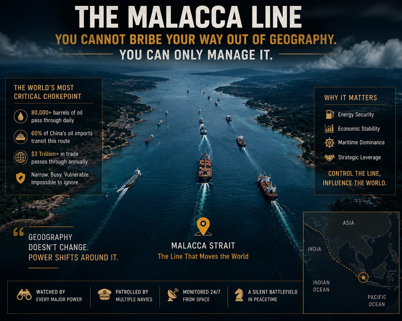
You cannot bribe your way out of geography. You can only manage it.
ACT VII — The Catch (Where the Thriller Meets the Footnotes)
Now for the part most viral threads leave out — because honest analysis demands it.
Could India (or the United States) actually close Malacca and squeeze China? Yes, on paper. Would it be the clean, surgical kill that breathless commentary implies? Almost certainly not. And a serious newsletter says so.
Start with the obvious: a blockade is an act of war. You do not throttle the world’s second-largest economy without expecting a response — economic, cyber, and very possibly military. China’s navy is no longer the coastal force of 2003; by hull count it is now the largest in the world, and it has been building toward exactly the kind of blue-water reach that a distant blockade is meant to deny. Beijing has also been stockpiling oil in strategic reserves precisely to ride out a months-long disruption, and any blockade would have to sort Chinese-bound cargo from neutral-flagged tankers carrying oil to dozens of other countries — Japan and South Korea among them, who together take several million barrels a day through the same strait. Choke Malacca and you don’t just hurt Beijing; you hurt Tokyo, Seoul, and the global economy your own country lives in.
And the nuclear shadow falls across all of it. Cornering a nuclear-armed great power’s energy supply is the kind of move that lives near the top of escalation ladders, not the bottom. The very effectiveness of the threat is also its danger.
Then there is India’s own vulnerability, which the cheerleaders rarely mention. Those islands sit in Seismic Zone V, the most active earthquake band in the country. The 2004 Indian Ocean tsunami devastated Great Nicobar; parts of the island subsided by metres, and the original Indira Point lighthouse stood half-submerged for years. The territory is 1,200 kilometres from the mainland — a long, thin supply line to defend. And the Great Nicobar mega-project carries a heavy moral and ecological bill that deserves naming, not burying: it threatens irreplaceable rainforest and coral, and the ancestral land of the Shompen, a particularly vulnerable tribal group numbering only a few hundred people. Strategic advantage and human cost are sitting on the same island, and pretending otherwise is dishonest.
So the truthful version of the thriller is quieter than the trailer: India’s position over Malacca is not a magic kill-switch. It is leverage — and leverage works best as a shadow, a “maybe,” a cost an adversary must price into every calculation. It shapes behaviour precisely because no one is sure exactly how, or whether, it would ever be used.
Which brings us to the last, strangest question the teaser asked.
ACT VIII — So Why Isn’t Anyone Talking About It?
If India holds a card this valuable, why the silence? Why the decades of “benign neglect,” the quiet press releases, the careful refusal to brag?
Three reasons, and they’re all deliberate.
First, ambiguity is the weapon. A blockade you announce is a blockade an enemy plans around. The Andaman and Nicobar lever derives its power from being unstated — a possibility that complicates Beijing’s every wartime assumption without ever forcing Delhi to commit to it. Strategists call this deterrence by uncertainty. Generals call it not showing your hand.
Second, India doesn’t want the war it would imply. Loudly framing the islands as a gun pointed at China’s throat invites exactly the encirclement — the Coco Islands listening post, the String of Pearls, the survey ships — that India would rather slow than accelerate. Quiet build-up, loud restraint. It is the posture of a country that wants the option without the provocation.
Third — and most human — the story is just hard to see. It lives in EIA spreadsheets and satellite imagery and the dry minutes of a defence dialogue most people have never heard of. It has no single dramatic moment, no declaration of war, no breaking-news chyron. It is a slow, structural truth — the kind that decides outcomes for decades while the world watches the louder chokepoint, Hormuz, light up the headlines.
But make no mistake about what is actually happening out there in the dark, warm water of the eastern Bay of Bengal.
A nation that controls roughly a third of its own ocean is, year by year, runway by runway, radar by radar, turning a forgotten archipelago into a fortress over the most important sea lane in Asia. A rival that runs on oil it cannot protect is building bases and listening posts to slip the noose. And every single day, 23 million barrels of the world’s lifeblood flow through a gap so narrow you could see both shores at once — past Indian islands, under American satellites, into Chinese refineries.
The chokepoint that could decide Asia is open this morning.
The only real question — the one that has kept admirals awake for twenty years — is what happens on the morning it isn’t.
The Silent Axis